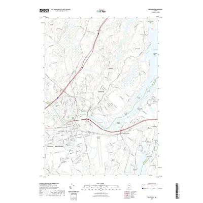
2021 Map of Brunswick
USGS Topo · Published 2021About this map
The Androscoggin River serves as the central artery and county boundary for this coastal Maine region, separating Brunswick in Cumberland County from Topsham in Sagadahoc County. The landscape is defined by its deep historical roots and institutional significance, anchored by the campus of Bowdoin College and a dense network of early burial sites. Genealogists can trace family heritage through numerous localized plots such as the Ancient Burying Ground, Riverview Cem, and the Heuston Burying Ground near Harding.
Find a feature on this map
228 named features on this map. Tap any name to fly to it.
Don’t see what you’re looking for? This feature index may not catch every label — zoom into the map to look around manually.
Map Details
Editions of this 2021 Brunswick Map
This is the sole edition of this map. No revisions or reprints were ever made.
Other maps of this area

1892 · Gardiner
USGS Topo · 1:62,500

1892 · Freeport
USGS Topo · 1:62,500

1894 · Bath
USGS Topo · 1:62,500

1908 · Lewiston
USGS Topo · 1:62,500

1920 · Bath
USGS Topo · 1:62,500

1941 · Freeport
USGS Topo · 1:62,500

1942 · Lewiston
USGS Topo · 1:62,500

1943 · Gardiner
USGS Topo · 1:62,500

1944 · Freeport
USGS Topo · 1:62,500

1945 · Bath
USGS Topo · 1:62,500