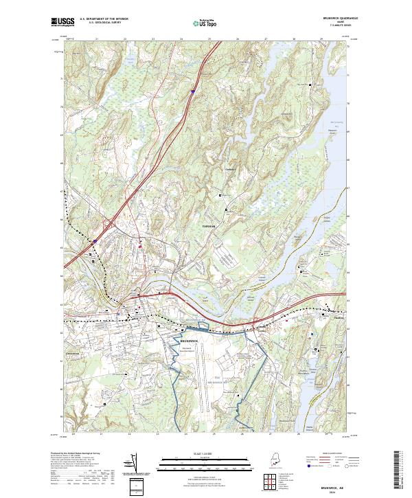
2024 Map of Brunswick
USGS Topo · Published 2024About this map
The Androscoggin River serves as the dividing line between the historic centers of Brunswick and Topsham, defining the industrial and educational heart of this coastal Maine region. In Brunswick, the campus of Bowdoin College and the sprawling infrastructure of NAS Brunswick ME, now home to the Brunswick Executive Airport, reflect the town's dual legacy of higher education and naval aviation. The map's detailed labeling provides a wealth of genealogical data, including the Ancient Burying Ground and Saint Paul's Memorial Garden. To the east, the landscape transitions into the tidal reaches of Merrymeeting Bay and Thomas Bay, where the Maine Central RR tracks navigate the complex shoreline near Harding and Cooks Corner. Smaller outlying settlements like Cathance and Growstown are anchored by family landmarks and numerous burial sites, such as the Heuston Burial Ground and the Annie Simpson Grave.
Find a feature on this map
220 named features on this map. Tap any name to fly to it.
Don’t see what you’re looking for? This feature index may not catch every label — zoom into the map to look around manually.
Map Details
Editions of this 2024 Brunswick Map
This is the sole edition of this map. No revisions or reprints were ever made.
Other maps of this area

1892 · Gardiner
USGS Topo · 1:62,500

1892 · Freeport
USGS Topo · 1:62,500

1894 · Bath
USGS Topo · 1:62,500

1908 · Lewiston
USGS Topo · 1:62,500

1920 · Bath
USGS Topo · 1:62,500

1941 · Freeport
USGS Topo · 1:62,500

1942 · Lewiston
USGS Topo · 1:62,500

1943 · Gardiner
USGS Topo · 1:62,500

1944 · Freeport
USGS Topo · 1:62,500

1945 · Bath
USGS Topo · 1:62,500