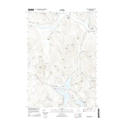
2014 Map of Bryant Pond
USGS Topo · Published 2014About this map
The Androscoggin River carves a path through this Oxford County landscape, defining the topography between Hanover and Rumford Corner. The 2014 survey reveals a transition from the river valley into the complex highlands of the Mahoosuc Range foothills, where elevations rise toward Howard Mountain and Wilbur Mountain. Local industry and community centers are anchored by the namesake Bryant Pond and the mill settlements of Locke Mills and Abbotts Mill.
Find a feature on this map
52 named features on this map. Tap any name to fly to it.
Don’t see what you’re looking for? This feature index may not catch every label — zoom into the map to look around manually.
Map Details
Editions of this 2014 Bryant Pond Map
This is the sole edition of this map. No revisions or reprints were ever made.
Other maps of this area

1911 · Bryant Pond
USGS Topo · 1:62,500

1914 · Bethel
USGS Topo · 1:62,500

1914 · Bryant Pond
USGS Topo · 1:62,500

1927 · Rumford
USGS Topo · 1:48,000

1930 · Rumford
USGS Topo · 1:62,500

1940 · Bethel
USGS Topo · 1:62,500

1941 · Bethel
USGS Topo · 1:62,500

1942 · Bryant Pond
USGS Topo · 1:62,500

1943 · Old Speck Mtn
USGS Topo · 1:62,500

1945 · Old Speck Mtn
USGS Topo · 1:62,500