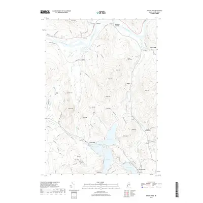
2018 Map of Bryant Pond
USGS Topo · Published 2018About this map
The Androscoggin River winds through the northern portion of this Oxford County landscape, anchoring the settlements of Hanover and Rumford Corner. To the south, a chain of glacial lakes including North Pond, South Pond, and Bryant Pond dictates the local geography and settlement patterns. The village of Locke Mills sits at the northern tip of this water chain, where the Alder River meets the ponds.
Find a feature on this map
111 named features on this map. Tap any name to fly to it.
Don’t see what you’re looking for? This feature index may not catch every label — zoom into the map to look around manually.
Map Details
Editions of this 2018 Bryant Pond Map
This is the sole edition of this map. No revisions or reprints were ever made.
Other maps of this area

1911 · Bryant Pond
USGS Topo · 1:62,500

1914 · Bethel
USGS Topo · 1:62,500

1914 · Bryant Pond
USGS Topo · 1:62,500

1927 · Rumford
USGS Topo · 1:48,000

1930 · Rumford
USGS Topo · 1:62,500

1940 · Bethel
USGS Topo · 1:62,500

1941 · Bethel
USGS Topo · 1:62,500

1942 · Bryant Pond
USGS Topo · 1:62,500

1943 · Old Speck Mtn
USGS Topo · 1:62,500

1945 · Old Speck Mtn
USGS Topo · 1:62,500