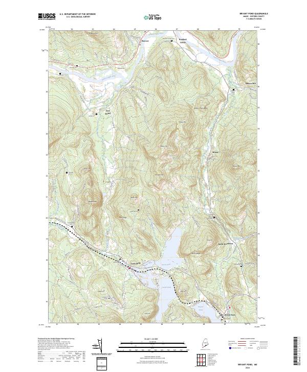
2024 Map of Bryant Pond
USGS Topo · Published 2024About this map
The Androscoggin River defines the northern reaches of this Oxford County landscape, winding past the settlements of Hanover and Rumford Corner. Further south, the terrain becomes a dense network of peaks and water bodies, centered on the village of Locke Mills and the twin basins of North Pond and South Pond. The geography here is heavily influenced by the drainage of the Alder River and Barkers Brook, which carve through a series of significant elevations including Barkers High Ledge, Pebley Mtn, and Kimball Hill.
Find a feature on this map
108 named features on this map. Tap any name to fly to it.
Don’t see what you’re looking for? This feature index may not catch every label — zoom into the map to look around manually.
Map Details
Editions of this 2024 Bryant Pond Map
This is the sole edition of this map. No revisions or reprints were ever made.
Other maps of this area

1911 · Bryant Pond
USGS Topo · 1:62,500

1914 · Bethel
USGS Topo · 1:62,500

1914 · Bryant Pond
USGS Topo · 1:62,500

1927 · Rumford
USGS Topo · 1:48,000

1930 · Rumford
USGS Topo · 1:62,500

1940 · Bethel
USGS Topo · 1:62,500

1941 · Bethel
USGS Topo · 1:62,500

1942 · Bryant Pond
USGS Topo · 1:62,500

1943 · Old Speck Mtn
USGS Topo · 1:62,500

1945 · Old Speck Mtn
USGS Topo · 1:62,500