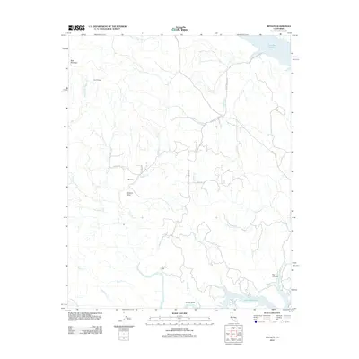
2012 Map of Bryson
USGS Topo · Published 2012About this map
Sapaque Valley forms a central geographical corridor through this part of the California Coast Ranges, where the settlement of Bryson sits at the junction of Sapaque Rd and Copperhead Rd. The map illustrates a landscape defined by seasonal drainages like Turtle Cr and Copperhead Cr flowing toward the larger reservoirs that anchor the northern and southern edges of the quadrangle. In the north, the shoreline of Lake San Antonio is visible near the Pleyto Cemetary Rd, while the southern reaches are dominated by the fingers of Lake Nacimiento. Ranching legacy is evident at Smith Ranch, while the name The Cantinas suggests localized history along the water. Significant elevation changes are marked by Bald Mountain in the northwest, overlooking the Nacimiento River as it winds toward Grizzly Bend.
Find a feature on this map
32 named features on this map. Tap any name to fly to it.
Don’t see what you’re looking for? This feature index may not catch every label — zoom into the map to look around manually.
Map Details
Editions of this 2012 Bryson Map
This is the sole edition of this map. No revisions or reprints were ever made.
Other maps of this area

1919 · Bryson
USGS Topo · 1:62,500

1919 · Bradley
USGS Topo · 1:62,500

1919 · Adelaida
USGS Topo · 1:62,500

1919 · San Simeon
USGS Topo · 1:62,500

1932 · Adelaida
USGS Topo · 1:62,500

1937 · San Simeon
USGS Topo · 1:62,500

1941 · Bradley
USGS Topo · 1:62,500

1941 · Bryson
USGS Topo · 1:62,500

1942 · Adelaida
USGS Topo · 1:62,500

1942 · Bryson
USGS Topo · 1:62,500