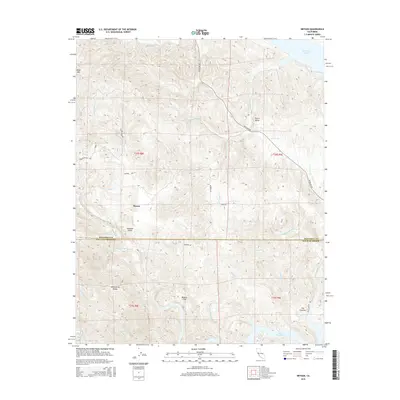
2015 Map of Bryson
USGS Topo · Published 2015About this map
Bryson sits at the heart of this landscape along the border of Monterey and San Luis Obispo counties, where the foothills of the Santa Lucia Range meet the drainages of major Central Coast reservoirs. The map shows a transition between the northern waters of Lake San Antonio and the southern reaches of Lake Nacimiento, linked by the winding course of the Nacimiento River. Local topography is defined by distinct valleys such as Harris Valley and Sapaque Valley, which provided historical corridors for early ranching and travel via routes like Sapaque Valley Rd and Interlake Rd. Named landmarks like Bald Mtn and The Cantinas rise above the complex network of seasonal creeks, including Copperhead Cr and Kavanaugh Cr. For researchers, the map provides precise placement of local settlements like Beasley Flat and the varied terrain of Lynch Canyon, capturing the rural character of this border region.
Find a feature on this map
39 named features on this map. Tap any name to fly to it.
Don’t see what you’re looking for? This feature index may not catch every label — zoom into the map to look around manually.
Map Details
Editions of this 2015 Bryson Map
This is the sole edition of this map. No revisions or reprints were ever made.
Other maps of this area

1919 · Bryson
USGS Topo · 1:62,500

1919 · Bradley
USGS Topo · 1:62,500

1919 · Adelaida
USGS Topo · 1:62,500

1919 · San Simeon
USGS Topo · 1:62,500

1932 · Adelaida
USGS Topo · 1:62,500

1937 · San Simeon
USGS Topo · 1:62,500

1941 · Bradley
USGS Topo · 1:62,500

1941 · Bryson
USGS Topo · 1:62,500

1942 · Adelaida
USGS Topo · 1:62,500

1942 · Bryson
USGS Topo · 1:62,500