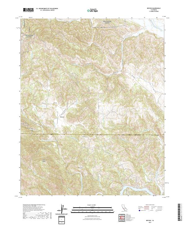
2021 Map of Bryson
USGS Topo · Published 2021About this map
Bryson sits at the heart of the Sapaque Valley, serving as a focal point for the rural ranching and residential life where Monterey Co and San Luis Obispo Co meet. This terrain is defined by the high ridges of the Santa Lucia Range to the west and the rolling elevations of Bold Mtn to the north, creating a complex network of seasonal drainages. Two primary waterways, the San Antonio River and the Nacimiento River, anchor the landscape, while numerous smaller creeks like Sapaque Cr and Copperhead Cr carve through the narrow valleys.
Find a feature on this map
42 named features on this map. Tap any name to fly to it.
Don’t see what you’re looking for? This feature index may not catch every label — zoom into the map to look around manually.
Map Details
Editions of this 2021 Bryson Map
This is the sole edition of this map. No revisions or reprints were ever made.
Other maps of this area

1919 · Bryson
USGS Topo · 1:62,500

1919 · Bradley
USGS Topo · 1:62,500

1919 · Adelaida
USGS Topo · 1:62,500

1919 · San Simeon
USGS Topo · 1:62,500

1932 · Adelaida
USGS Topo · 1:62,500

1937 · San Simeon
USGS Topo · 1:62,500

1941 · Bradley
USGS Topo · 1:62,500

1941 · Bryson
USGS Topo · 1:62,500

1942 · Adelaida
USGS Topo · 1:62,500

1942 · Bryson
USGS Topo · 1:62,500