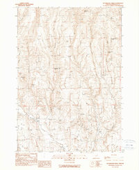
1990 Map of Buckbrush Creek
USGS Topo · Published 1990About this map
Buckbrush Creek carves through this high desert terrain in Malheur County, where the 1990 landscape is defined by its water management and volcanic geography. The map reveals a network of essential water sources in an arid environment, including Chalk Spring, North Salter Spring, and Bull Spring, alongside man-made improvements such as the Clover Ditch and Soldiers Canyon Reservoir. These features speak to the long-standing ranching and irrigation history of eastern Oregon, where every seep and spring was a vital point of interest. Distinctive landmarks like Little Poison Butte and Big Poison Butte punctuate the horizon, while smaller watercourses like Pancake Creek and Birch Creek feed toward the Bully Creek drainage. Traces of historical exploration are found in localized Prospect markings, indicating the search for mineral resources within the deep cuts of Timber Canyon and Soldiers Canyon.
Find a feature on this map
23 named features on this map. Tap any name to fly to it.
Don’t see what you’re looking for? This feature index may not catch every label — zoom into the map to look around manually.
Map Details
Editions of this 1990 Buckbrush Creek Map
This is the sole edition of this map. No revisions or reprints were ever made.
Other maps of this area

1955 · Baker
USGS Topo · 1:250,000

1955 · Boise
USGS Topo · 1:250,000

1958 · Boise
USGS Topo · 1:250,000

1959 · Baker
USGS Topo · 1:250,000

1962 · Boise
USGS Topo · 1:250,000

1964 · Brogan
USGS Topo · 1:62,500

1966 · Clover Creek Ranch
USGS Topo · 1:62,500

1966 · Harper
USGS Topo · 1:62,500

1966 · Westfall Butte
USGS Topo · 1:62,500

1980 · Brogan
USGS Topo · 1:100,000