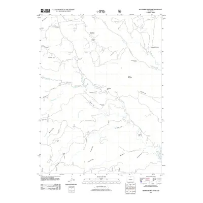
2011 Map of Buckhorn Mountain
USGS Topo · Published 2011About this map
Vannorsdel Family Cemetery and several other small burial sites suggest the deep-rooted family lineage of this mountain landscape. Situated around the prominent Buckhorn Mountain, the terrain is marked by historical extraction sites such as the Wisdom Ranch Mine and the Buckhorn Mica Mine near Mica Mine Ridge. The network of creeks including Redstone Creek, Stove Prairie Creek, and Buckhorn Creek defines the local topography, while historic routes like Old Flowers Rd and Buckhorn Rd connect remote landmarks. Local gatherings and residence are anchored by Buckhorn Lodge and the Buckhorn Canyon Campground, while the surrounding geography features descriptive names such as Deadman Hill, Happy Hollow, and Stringtown Gulch. This map provides genealogists with a clear view of scattered family properties and the industrial footprint left by mica mining operations.
Find a feature on this map
56 named features on this map. Tap any name to fly to it.
Don’t see what you’re looking for? This feature index may not catch every label — zoom into the map to look around manually.
Map Details
Editions of this 2011 Buckhorn Mountain Map
This is the sole edition of this map. No revisions or reprints were ever made.
Other maps of this area

1905 · Mount Olympus
USGS Topo · 1:62,500

1906 · Loveland
USGS Topo · 1:62,500

1906 · Fort Collins
USGS Topo · 1:62,500

1907 · Mount Olympus
USGS Topo · 1:62,500

1907 · Livermore
USGS Topo · 1:125,000

1908 · Loveland
USGS Topo · 1:62,500

1908 · Fort Collins
USGS Topo · 1:62,500

1909 · Livermore
USGS Topo · 1:125,000

1954 · Greeley
USGS Topo · 1:250,000

1957 · Greeley
USGS Topo · 1:250,000