
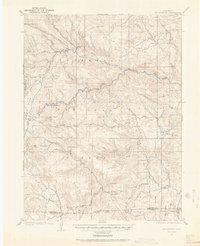
1905 Map of Mount Olympus
USGS Topo · Published 1955About this map
Big Thompson River carves a central path through this terrain, where early 20th-century life centered on family-held ranches and seasonal mountain hotels. The landscape is dotted with several significant private holdings, including Dunraven Ranch, Bryants Ranch, and Meadowdale Ranch, alongside the early resort atmosphere at the Rustic Hotel. These settlements and the presence of The Orchard suggest a period where agriculture and nascent tourism coexisted in the valleys before larger-scale modern development.
Find a feature on this map
63 named features on this map. Tap any name to fly to it.
Don’t see what you’re looking for? This feature index may not catch every label — zoom into the map to look around manually.
Map Details
Editions of this 1905 Mount Olympus Map
2 editions found
Other maps of this area

1902 · Boulder
USGS Topo · 1:62,500

1904 · Niwot
USGS Topo · 1:62,500

1904 · Boulder
USGS Topo · 1:62,500

1906 · Loveland
USGS Topo · 1:62,500

1906 · Fort Collins
USGS Topo · 1:62,500

1907 · Mount Olympus
USGS Topo · 1:62,500

1907 · Livermore
USGS Topo · 1:125,000

1908 · Loveland
USGS Topo · 1:62,500

1908 · Fort Collins
USGS Topo · 1:62,500

1909 · Livermore
USGS Topo · 1:125,000