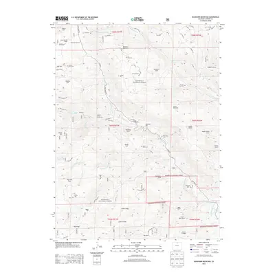
2013 Map of Buckhorn Mountain
USGS Topo · Published 2013About this map
Roosevelt National Forest dominates this section of Larimer County, where the high-altitude landscape is defined by the drainages of Buckhorn Creek and Stove Prairie Creek. For genealogists and local historians, the area is notably peppered with small, family-associated burial sites and individual markers, including the Vannorsdel Family Cem, Lass Family Cem, and the Charles C Green Grave. These sites, alongside larger plots like Thomson Cem and Pittington Family Cem, suggest a history of dispersed homesteading and small-scale ranching throughout the mountain gulches. Small settlements and waypoints like Stringtown and Buckhorn Lodge appear along the drainage networks, while evidence of earlier land use is found at Mica Mine Ridge. The complex water management of the region is illustrated by the Buckhorn Highline Ditch, which traverses the eastern slopes near Fletcher Hill.
Find a feature on this map
78 named features on this map. Tap any name to fly to it.
Don’t see what you’re looking for? This feature index may not catch every label — zoom into the map to look around manually.
Map Details
Editions of this 2013 Buckhorn Mountain Map
This is the sole edition of this map. No revisions or reprints were ever made.
Other maps of this area

1905 · Mount Olympus
USGS Topo · 1:62,500

1906 · Loveland
USGS Topo · 1:62,500

1906 · Fort Collins
USGS Topo · 1:62,500

1907 · Mount Olympus
USGS Topo · 1:62,500

1907 · Livermore
USGS Topo · 1:125,000

1908 · Loveland
USGS Topo · 1:62,500

1908 · Fort Collins
USGS Topo · 1:62,500

1909 · Livermore
USGS Topo · 1:125,000

1954 · Greeley
USGS Topo · 1:250,000

1957 · Greeley
USGS Topo · 1:250,000