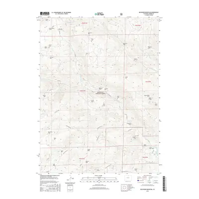
2016 Map of Buckhorn Mountain
USGS Topo · Published 2016About this map
Vannorsdel Family Cem and Lass Family Cem are among several small burial sites scattered across this high-elevation landscape within the Roosevelt National Forest. The map documents a rugged terrain of ridges and gulches, where family-named landmarks like Thomson Cem and the Charles C Green Grave provide valuable data for genealogists tracing early settlers in this part of Larimer County. The settlement pattern follows the drainage of Stove Prairie Cr and Buckhorn Cr, with clearings such as High Park and Paradise Park indicating habitable pockets amid the steep slopes of Buckhorn Mtn. Resource extraction history is signaled by Mica Mine Ridge, while the network of mountain routes, including CO Road 27 and the Stringtown Gulch road, shows the modern connectivity through Deadman Hill and Fiddler Ridge.
Find a feature on this map
60 named features on this map. Tap any name to fly to it.
Don’t see what you’re looking for? This feature index may not catch every label — zoom into the map to look around manually.
Map Details
Editions of this 2016 Buckhorn Mountain Map
This is the sole edition of this map. No revisions or reprints were ever made.
Other maps of this area

1905 · Mount Olympus
USGS Topo · 1:62,500

1906 · Loveland
USGS Topo · 1:62,500

1906 · Fort Collins
USGS Topo · 1:62,500

1907 · Mount Olympus
USGS Topo · 1:62,500

1907 · Livermore
USGS Topo · 1:125,000

1908 · Loveland
USGS Topo · 1:62,500

1908 · Fort Collins
USGS Topo · 1:62,500

1909 · Livermore
USGS Topo · 1:125,000

1954 · Greeley
USGS Topo · 1:250,000

1957 · Greeley
USGS Topo · 1:250,000