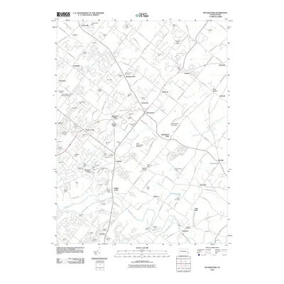
2010 Map of Buckingham
USGS Topo · Published 2010About this map
Buckingham Mountain and its smaller neighbor, Little Buckingham Mountain, rise above a landscape defined by historic crossroads and evolving suburban infrastructure in the early 21st century. This portion of Bucks County shows a dense network of local routes such as Street Rd and Durham Rd, which link established villages like Mechanicsville and Lahaska. The map provides a detailed view of the regional postal network, identifying specific locations for the Pineville Post Office and Rushland Post Office, alongside community landmarks like Plumstead Cemetery and the Doylestown Airport.
Find a feature on this map
154 named features on this map. Tap any name to fly to it.
Don’t see what you’re looking for? This feature index may not catch every label — zoom into the map to look around manually.
Map Details
Editions of this 2010 Buckingham Map
This is the sole edition of this map. No revisions or reprints were ever made.
Other maps of this area

1890 · Lambertville
USGS Topo · 1:62,500

1890 · Doylestown
USGS Topo · 1:62,500

1890 · Burlington
USGS Topo · 1:62,500

1891 · Lambertville
USGS Topo · 1:62,500

1891 · Doylestown
USGS Topo · 1:62,500

1893 · Germantown
USGS Topo · 1:62,500

1893 · Burlington
USGS Topo · 1:62,500

1894 · Lambertville
USGS Topo · 1:62,500

1894 · Germantown
USGS Topo · 1:62,500

1896 · Germantown
USGS Topo · 1:62,500
Featured Places
- Warrington Township, PA
- Buckingham Township, PA
- Solebury Township, PA
- Doylestown, PA
- Wrightstown Township, PA