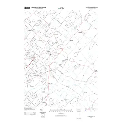
2013 Map of Buckingham
USGS Topo · Published 2013About this map
Buckingham and its surrounding hamlets illustrate a landscape of enduring village centers and evolving suburban development in central Bucks County. This survey reveals the dense network of crossroads settlements that have historically defined the region, including Furlong, Lahaska, and Wycombe. The terrain is marked by the prominent ridge of Buckingham Mountain and its smaller counterpart, Little Buckingham Mountain, which influence the drainage patterns of local waterways like Lahaska Cr and Pidcock Cr. Toward the south, the Neshaminy Cr meanders past Bridge Valley and Jamison, while the eastern portion of the map shows the more open agricultural reaches around Pineville. Local history is embedded in the numerous small settlements such as Mozart, Mechanicsville, and Little Italy, each reflecting the tight-knit community clusters typical of this part of Pennsylvania.
Find a feature on this map
354 named features on this map. Tap any name to fly to it.
Don’t see what you’re looking for? This feature index may not catch every label — zoom into the map to look around manually.
Map Details
Editions of this 2013 Buckingham Map
This is the sole edition of this map. No revisions or reprints were ever made.
Other maps of this area

1890 · Lambertville
USGS Topo · 1:62,500

1890 · Doylestown
USGS Topo · 1:62,500

1890 · Burlington
USGS Topo · 1:62,500

1891 · Lambertville
USGS Topo · 1:62,500

1891 · Doylestown
USGS Topo · 1:62,500

1893 · Germantown
USGS Topo · 1:62,500

1893 · Burlington
USGS Topo · 1:62,500

1894 · Lambertville
USGS Topo · 1:62,500

1894 · Germantown
USGS Topo · 1:62,500

1896 · Germantown
USGS Topo · 1:62,500
Featured Places
- Warrington Township, PA
- Buckingham Township, PA
- Solebury Township, PA
- Doylestown, PA
- Wrightstown Township, PA