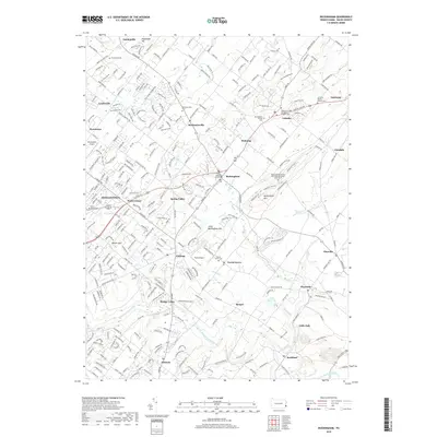
2019 Map of Buckingham
USGS Topo · Published 2019About this map
Buckingham Mountain and its smaller neighbor, Little Buckingham Mountain, anchor the central terrain of this Bucks County region. The landscape is defined by a dense network of residential development and older rural settlements, connected by a intricate web of roads such as Valley Road and Point Pleasant Pike. Historically significant sites are numerous, including the Mount Gilead African Methodist Episcopal Church Cemetery and the Buckingham Friends Cemetery, reflecting the long-established communities of Holicong, Lahaska, and Mechanicsville. To the west, the busy corridor near Doylestown and Doylestown Airport contrasts with the riparian corridors of Neshaminy Creek and Robin Run. Further south, smaller locales like Little Italy, Wycombe, and Rushland trace the lower reaches of the local watersheds, where Robin Run Lake and various smaller creeks like Watson Creek drain the undulating hills of Warrington Township.
Find a feature on this map
293 named features on this map. Tap any name to fly to it.
Don’t see what you’re looking for? This feature index may not catch every label — zoom into the map to look around manually.
Map Details
Editions of this 2019 Buckingham Map
This is the sole edition of this map. No revisions or reprints were ever made.
Other maps of this area

1890 · Lambertville
USGS Topo · 1:62,500

1890 · Doylestown
USGS Topo · 1:62,500

1890 · Burlington
USGS Topo · 1:62,500

1891 · Lambertville
USGS Topo · 1:62,500

1891 · Doylestown
USGS Topo · 1:62,500

1893 · Germantown
USGS Topo · 1:62,500

1893 · Burlington
USGS Topo · 1:62,500

1894 · Lambertville
USGS Topo · 1:62,500

1894 · Germantown
USGS Topo · 1:62,500

1896 · Germantown
USGS Topo · 1:62,500
Featured Places
- Warrington Township, PA
- Buckingham Township, PA
- Solebury Township, PA
- Doylestown, PA
- Wrightstown Township, PA