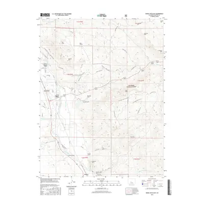
2016 Map of Buena Vista East
USGS Topo · Published 2016About this map
Arkansas River flows through the heart of this Chaffee County landscape, anchoring a valley where water management and recreation dominate the terrain. To the west, the eastern fringes of Buena Vista and the junction at Johnson Village demonstrate the area's development along the river corridor, supported by an intricate network of irrigation channels like Helena Ditch and Trout Cr Ditch. The presence of Coal Kiln Gulch near the southern settlement of Nathrop points to the region's industrial heritage, while the extensive Midland Bike Trail follows a legacy path through the hills. Eastward, the terrain rises into the San Isabel National Forest, marked by distinctive peaks such as Sugarloaf Mtn and Ruby Mtn. This topography creates a clear divide between the agricultural and residential activity near the river and the wilder, ridge-dominated landscape of Limestone Ridge.
Find a feature on this map
61 named features on this map. Tap any name to fly to it.
Don’t see what you’re looking for? This feature index may not catch every label — zoom into the map to look around manually.
Map Details
Editions of this 2016 Buena Vista East Map
This is the sole edition of this map. No revisions or reprints were ever made.
Other maps of this area

1954 · Pueblo
USGS Topo · 1:250,000

1955 · Buena Vista
USGS Topo · 1:62,500

1956 · Antero Reservoir
USGS Topo · 1:24,000

1956 · Cameron Mountain
USGS Topo · 1:62,500

1956 · Poncha Springs
USGS Topo · 1:62,500

1956 · Montrose
USGS Topo · 1:250,000

1957 · Pueblo
USGS Topo · 1:250,000

1958 · Pueblo
USGS Topo · 1:250,000

1959 · Montrose
USGS Topo · 1:250,000

1959 · Antero Reservoir
USGS Topo · 1:62,500