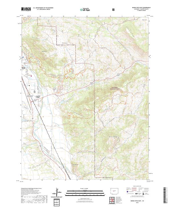
2022 Map of Buena Vista East
USGS Topo · Published 2022About this map
Johnson Village and the eastern outskirts of Buena Vista anchor this Chaffee County landscape, where the Arkansas River carves a path through the high valley. The map documents an intricate network of modern recreation and legacy water rights, from the numerous branches of the Midland Bike Trl to the critical irrigation channels of the Helena Ditch, Trout Cr Ditch, and Bray Ditch. To the east, the terrain rises into the San Isabel National Forest, marked by distinctive peaks like Sugarloaf Mtn and Bald Mtn. The survey also captures vital local infrastructure, including the Central Colorado Regional Airport and the bridge crossing at Fisherman's Bridge Rd. These features illustrate the area's dual character as a transportation corridor and a destination for back-country exploration via trails like the Zebulon Pike Trl and Triad Ridge Atv Trl.
Find a feature on this map
65 named features on this map. Tap any name to fly to it.
Don’t see what you’re looking for? This feature index may not catch every label — zoom into the map to look around manually.
Map Details
Editions of this 2022 Buena Vista East Map
This is the sole edition of this map. No revisions or reprints were ever made.
Other maps of this area

1954 · Pueblo
USGS Topo · 1:250,000

1955 · Buena Vista
USGS Topo · 1:62,500

1956 · Antero Reservoir
USGS Topo · 1:24,000

1956 · Cameron Mountain
USGS Topo · 1:62,500

1956 · Poncha Springs
USGS Topo · 1:62,500

1956 · Montrose
USGS Topo · 1:250,000

1957 · Pueblo
USGS Topo · 1:250,000

1958 · Pueblo
USGS Topo · 1:250,000

1959 · Montrose
USGS Topo · 1:250,000

1959 · Antero Reservoir
USGS Topo · 1:62,500