
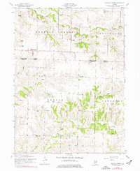
1953 Map of Buffalo Prairie
USGS Topo · Published 1958About this map
Buffalo Prairie serves as the central hub of this agricultural landscape in the early 1950s, situated near the boundary line between Rock Island County and Mercer County. The settlement pattern is defined by a dense network of local civic institutions, including the Duncan Town Hall and a notable concentration of rural education sites such as North Buffalo Prairie School, East Buffalo Prairie School, and Oakdale School. These small schoolhouses and churches like Antioch Church underscore the importance of local community centers in this Illinois prairie region during the mid-century.
Find a feature on this map
30 named features on this map. Tap any name to fly to it.
Don’t see what you’re looking for? This feature index may not catch every label — zoom into the map to look around manually.
Map Details
Editions of this 1953 Buffalo Prairie Map
2 editions found
Other maps of this area

1912 · Milan
USGS Topo · 1:62,500

1916 · Edgington
USGS Topo · 1:62,500

1923 · Alexis
USGS Topo · 1:62,500

1925 · Alexis
USGS Topo · 1:62,500

1935 · Keithsburg
USGS Topo · 1:48,000

1938 · Edgington
USGS Topo · 1:62,500

1941 · Keithsburg
USGS Topo · 1:62,500

1944 · Milan
USGS Topo · 1:62,500
1953 · Illinois City
USGS Topo · 1:24,000
1953 · Aledo East
USGS Topo · 1:24,000