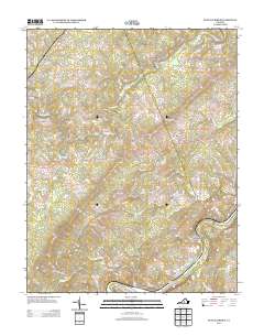
2013 Map of Buffalo Ridge
USGS Topo · Published 2013About this map
The James River and its major tributaries define this landscape along the southern edge of Amherst County, where the water cuts through the prominent heights of Buffalo Ridge and Dyestone Ridge. The small settlements of Riverville and Walkers Ford are situated near the riverbanks, marking long-standing points of transit and river-based industry in the region. To the north, the Buffalo River winds through deep valleys, joined by numerous smaller streams like Rocky Cr and Allens Creek. The presence of features such as Wreck Island and Christian Island within the James River channel illustrates the complex hydrology of the Piedmont region. Historical development is visible through a network of local roads and family-named landmarks such as Larkin Mountain and Grandmas Hill Road, providing a clear view of the rural settlement patterns and topographic constraints that have shaped this portion of Virginia.
Find a feature on this map
69 named features on this map. Tap any name to fly to it.
Don’t see what you’re looking for? This feature index may not catch every label — zoom into the map to look around manually.
Map Details
Editions of this 2013 Buffalo Ridge Map
This is the sole edition of this map. No revisions or reprints were ever made.
Other maps of this area

1892 · Lynchburg
USGS Topo · 1:125,000

1892 · Buckingham
USGS Topo · 1:125,000

1892 · Appomattox
USGS Topo · 1:125,000

1894 · Lexington
USGS Topo · 1:125,000

1935 · Amherst
USGS Topo · 1:48,000

1939 · Amherst
USGS Topo · 1:62,500

1944 · Lynchburg
USGS Topo · 1:62,500

1947 · Roanoke
USGS Topo · 1:250,000

1950 · Amherst
USGS Topo · 1:62,500

1950 · Lynchburg
USGS Topo · 1:62,500