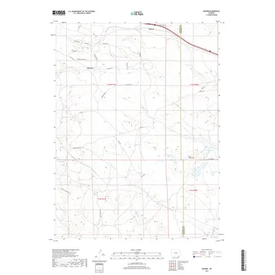
2017 Map of Buford
USGS Topo · Published 2017About this map
Buford and Sherman sit along the high plains of the Albany Co Laramie Co line, representing historic stops along a vital transportation corridor through Wyoming. The landscape is defined by the high-elevation drainage systems of Lone Tree Cr and Duck Cr, which flow through a network of rural routes like Dizzy Horse Rd and Pumpkin Vine Rd. This 2017 survey illustrates the modern configuration of the area’s ranching and residential infrastructure, showing how local roads like Brumbaugh Rd and Fuller Rd provide access to the foothills near Twin Mountains. The presence of Twin Mountains Lake and various smaller water bodies, including Deadman Cr, underscores the importance of water management in this arid, high-country environment where the Continental Divide's influence is felt in the local hydrology.
Find a feature on this map
37 named features on this map. Tap any name to fly to it.
Don’t see what you’re looking for? This feature index may not catch every label — zoom into the map to look around manually.
Map Details
Editions of this 2017 Buford Map
This is the sole edition of this map. No revisions or reprints were ever made.
Other maps of this area

1905 · Sherman
USGS Topo · 1:125,000

1907 · Livermore
USGS Topo · 1:125,000

1909 · Livermore
USGS Topo · 1:125,000

1948 · Sherman Mountains
USGS Topo · 1:62,500

1950 · Sherman Mountains
USGS Topo · 1:62,500

1954 · Cheyenne
USGS Topo · 1:250,000

1954 · Greeley
USGS Topo · 1:250,000

1957 · Greeley
USGS Topo · 1:250,000

1958 · Cheyenne
USGS Topo · 1:250,000

1958 · Greeley
USGS Topo · 1:250,000