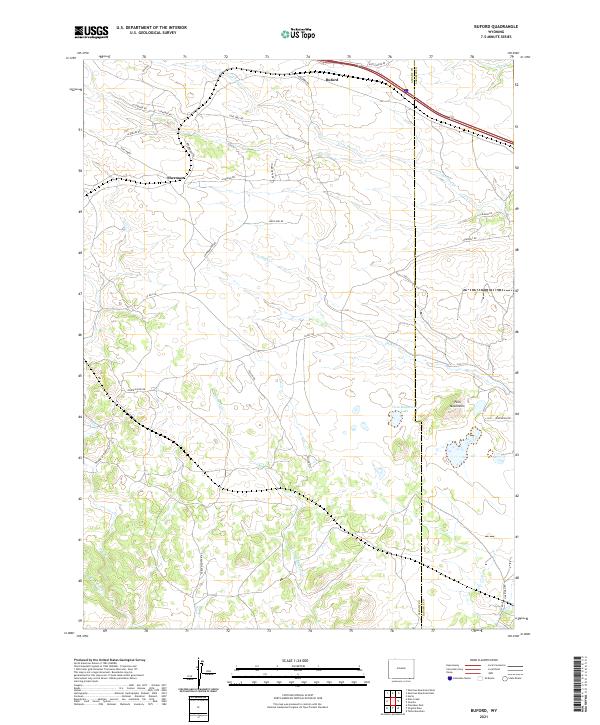
2021 Map of Buford
USGS Topo · Published 2021About this map
Buford and the nearby site of Sherman anchor this high-plains landscape along the Interstate 80 corridor. The area is defined by its drainage systems and distinct topographic markers like the Twin Mountains, which rise near the eastern edge of the Albany Co Laramie Co line. Significant water features including Lone Tree Cr, Duck Cr, and Deadman Cr cross the terrain, illustrating the natural watershed that has historically influenced travel and settlement patterns in this part of Wyoming. A dense network of local roads such as Pumpkin Vine Rd and Double-XX Ranch Rd reach into the surrounding ranchlands. The presence of Twin Mountains Lake provides a notable landmark amidst the undulating contours of the Laramie Mountains foothills, offering a detailed look at the rural infrastructure of the early 2020s.
Find a feature on this map
35 named features on this map. Tap any name to fly to it.
Don’t see what you’re looking for? This feature index may not catch every label — zoom into the map to look around manually.
Map Details
Editions of this 2021 Buford Map
This is the sole edition of this map. No revisions or reprints were ever made.
Other maps of this area

1905 · Sherman
USGS Topo · 1:125,000

1907 · Livermore
USGS Topo · 1:125,000

1909 · Livermore
USGS Topo · 1:125,000

1948 · Sherman Mountains
USGS Topo · 1:62,500

1950 · Sherman Mountains
USGS Topo · 1:62,500

1954 · Cheyenne
USGS Topo · 1:250,000

1954 · Greeley
USGS Topo · 1:250,000

1957 · Greeley
USGS Topo · 1:250,000

1958 · Cheyenne
USGS Topo · 1:250,000

1958 · Greeley
USGS Topo · 1:250,000