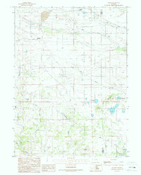
1987 Map of Buford
USGS Topo · Published 1987About this map
Union Pacific rail lines dominate this stretch of the high plains, charting a path through the southern Wyoming highlands where the Albany Co and Laramie Co border meets. The map documents several historically significant stops along the transcontinental route, including the high-elevation settlement of Sherman and the small outpost of Buford. The terrain is defined by a series of drainages, most notably Lone Tree Creek in the north and the complex network of Dale Creek and its West Fork to the south. Local landmarks like the Twin Mountains and Mound Mountain rise above the drainage basins of Deadman Fork and Mason Allen Creek. This 1987 provisional survey also captures industrial markers such as a remote Prospect and several segments of a prominent Transmission Line, illustrating the continued utility of this corridor for national infrastructure and transportation.
Find a feature on this map
20 named features on this map. Tap any name to fly to it.
Don’t see what you’re looking for? This feature index may not catch every label — zoom into the map to look around manually.
Map Details
Editions of this 1987 Buford Map
This is the sole edition of this map. No revisions or reprints were ever made.
Other maps of this area

1905 · Sherman
USGS Topo · 1:125,000

1907 · Livermore
USGS Topo · 1:125,000

1909 · Livermore
USGS Topo · 1:125,000

1948 · Sherman Mountains
USGS Topo · 1:62,500

1950 · Sherman Mountains
USGS Topo · 1:62,500

1954 · Cheyenne
USGS Topo · 1:250,000

1954 · Greeley
USGS Topo · 1:250,000

1957 · Greeley
USGS Topo · 1:250,000

1958 · Cheyenne
USGS Topo · 1:250,000

1958 · Greeley
USGS Topo · 1:250,000