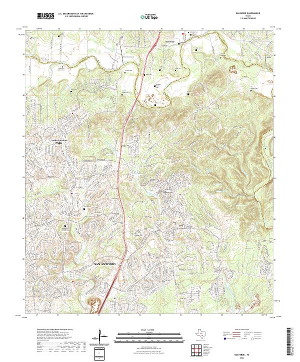
2022 Map of Bulverde
USGS Topo · Published 2022About this map
Cibolo Cr and its numerous tributaries, including Clear Fork and Elm Waterhole Cr, carve through the complex Hill Country topography along the Bexar and Comal County line. This 2022 survey captures the modern expansion of San Antonio and Timberwood Park as they push northward into the rural landscape around Bulverde. The map is exceptionally valuable for genealogical research, preserving the locations of numerous family burial grounds such as Groenke Cem, Wilhelm Weidner Cem, and the Traugott Family Farm Cem.
Find a feature on this map
336 named features on this map. Tap any name to fly to it.
Don’t see what you’re looking for? This feature index may not catch every label — zoom into the map to look around manually.
Map Details
Editions of this 2022 Bulverde Map
This is the sole edition of this map. No revisions or reprints were ever made.
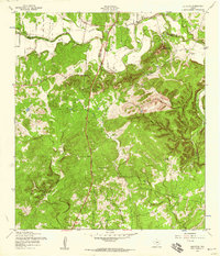
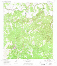
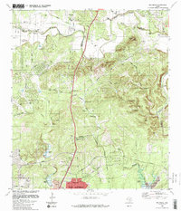
Historical Maps of San Antonio Through Time
4 maps found