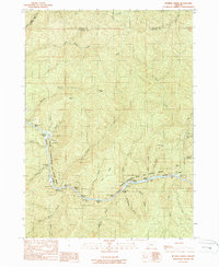
1989 Map of Bunker Creek
USGS Topo · Published 1989About this map
The Rogue National Wild and Scenic River dominates this landscape, carving a deep canyon through the Klamath Mountains at the border of Josephine, Douglas, and Curry counties. This late-1980s survey documents the hazardous navigable character of the waterway, naming specific navigational points like Slim Pickins Rapids, Russian Rapids, and Windy Creek Chute. Evidence of the region’s mineral history is found at the Benton Mine and Reno Mine, while remote human activity is noted at Whiskey Creek Cabin and various seasonal sites such as Trappers Camp. The intricate network of drainages, including Bunker Creek and Kelsey Creek, illustrates the complex hydrology of this steep terrain, where early transport relied on trails like Telephone Hole Riffle rather than established roads.
Find a feature on this map
54 named features on this map. Tap any name to fly to it.
Don’t see what you’re looking for? This feature index may not catch every label — zoom into the map to look around manually.
Map Details
Editions of this 1989 Bunker Creek Map
This is the sole edition of this map. No revisions or reprints were ever made.
Other maps of this area

1946 · Galice
USGS Topo · 1:62,500

1946 · Dutchman Butte
USGS Topo · 1:62,500

1948 · Galice
USGS Topo · 1:62,500

1948 · Dutchman Butte
USGS Topo · 1:62,500

1954 · Bone Mountain
USGS Topo · 1:62,500

1954 · Marial
USGS Topo · 1:62,500

1955 · Medford
USGS Topo · 1:250,000

1957 · Medford
USGS Topo · 1:250,000

1958 · Medford
USGS Topo · 1:250,000
1989 · Hobson Horn
USGS Topo · 1:24,000