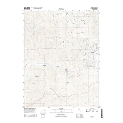
2015 Map of Burbeck
USGS Topo · Published 2015About this map
The California Western RR carves a winding path through the Mendocino County hills, following the course of the Noyo River to serve historic timber and transportation points. Small settlements and former mill sites such as Shake City, Burbeck, and Clare Mill dot the river valley, marking the industrial legacy of the region's redwood forests. In the east, the residential expansion of Brooktrails is evident, with a dense network of roads like Sherwood Rd and Ridge Rd weaving through the upland terrain near Lake Emily. The landscape is defined by its dramatic relief, from the heights of Three Chop Ridge in the west to the numerous canyons carved by waterways like Hayworth Cr, Soda Cr, and Willits Cr. This map documents a modern view of a region where old logging infrastructure and newer residential developments coexist among the steep drainages of the North Coast Ranges.
Find a feature on this map
93 named features on this map. Tap any name to fly to it.
Don’t see what you’re looking for? This feature index may not catch every label — zoom into the map to look around manually.
Map Details
Editions of this 2015 Burbeck Map
This is the sole edition of this map. No revisions or reprints were ever made.
Other maps of this area

1920 · Glenblair
USGS Topo · 1:62,500

1921 · Branscomb
USGS Topo · 1:62,500

1922 · Willits
USGS Topo · 1:62,500

1942 · Willits
USGS Topo · 1:62,500

1943 · Glenblair
USGS Topo · 1:62,500

1944 · Willits
USGS Topo · 1:62,500

1951 · Branscomb
USGS Topo · 1:62,500

1951 · Laytonville
USGS Topo · 1:62,500

1957 · Ukiah
USGS Topo · 1:250,000

1960 · Ukiah
USGS Topo · 1:250,000