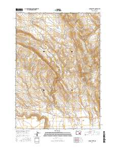
2017 Map of Burns Butte
USGS Topo · Published 2017About this map
Burns Butte rises as a prominent landmark in this High Desert landscape of Harney County, presiding over a network of canyons and seasonal drainages. Water management is central to the land's utility, evidenced by a series of upland catchments including Erenos Reservoir, Halfway Reservoir, and the W Willow Cr Reservoir. These features, along with named water sources like Rimrock Spring and Alder Spring, support the ranching and timber interests that define the region. The map details a transition from the broad, open Willow Creek Flats in the north to the confined drainages of Fenwick Canyon and Brush Canyon. Navigation across this terrain relies on a system of forest and logging roads such as Radar Rd, Hines Logging Rd, and Nat For Dev Rd 47, illustrating the area's ongoing importance for resource access and land management in the 21st century.
Find a feature on this map
32 named features on this map. Tap any name to fly to it.
Don’t see what you’re looking for? This feature index may not catch every label — zoom into the map to look around manually.
Map Details
Editions of this 2017 Burns Butte Map
This is the sole edition of this map. No revisions or reprints were ever made.
Other maps of this area

1955 · Burns
USGS Topo · 1:250,000

1958 · Burns
USGS Topo · 1:250,000

1959 · Burns
USGS Topo · 1:250,000

1959 · Dog Mountain
USGS Topo · 1:62,500

1960 · Burns
USGS Topo · 1:62,500

1960 · Burns
USGS Topo · 1:24,000

1975 · Burns
USGS Topo · 1:24,000

1980 · Palomino Buttes
USGS Topo · 1:24,000

1981 · Sage Hen Hill
USGS Topo · 1:24,000
1981 · Holmes Canyon
USGS Topo · 1:24,000