2023 Map of Burnside
USGS Topo · Published 2023About this map
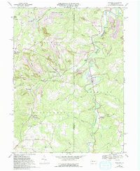
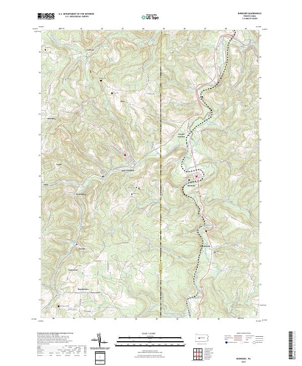
Burnside and Glen Campbell anchor this portion of the Pennsylvania coal and timber country, situated along the winding upper reaches of the West Branch Susquehanna River. The landscape is defined by its deep-seated local history, evidenced by a high density of family and community burial grounds such as Sunderland Cem, Graham Cem, and Brickell Cem that dot the ridges. The settlement pattern follows the narrow valleys of Cush Creek and Rock Run, where small communities like Arcadia, Patchinville, and Dowler Junction emerged along the river and rail corridors. Genealogists will find particular value in the specific church-affiliated sites, including the United Brethren in Christ Church Cem and Saint Michaels Cem. This modern survey also highlights the recreation potential of the area via the Susquehanna River Water Trail - West Branch Trl as it follows the river's path through the Indiana Co and Clearfield Co borderlands.
Find a feature on this map
86 named features on this map. Tap any name to fly to it.
Don’t see what you’re looking for? This feature index may not catch every label — zoom into the map to look around manually.
Map Details
Editions of this 2023 Burnside Map
This is the sole edition of this map. No revisions or reprints were ever made.