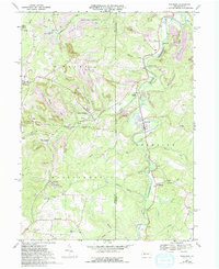
1968 Map of Burnside
USGS Topo · Published 1994About this map
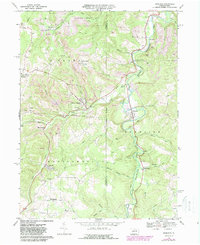
The Susquehanna River West Branch carves through this landscape on the border of Indiana and Clearfield counties, reflecting an era of heavy industrial extraction and small-town resilience. The map reveals a land transformed by mining, where extensive purple-tinted areas denote reclaimed strip mines alongside active operations. In the borough of Burnside, the river meanders past residential clusters, while to the west, Glen Campbell serves as a hub near State Game Lands No 174. Genealogical details are prominent throughout the rural countryside, including the Urey Cem and SS Peter and Paul Ch near the settlement of Urey. The presence of an Old Railroad Grade and Dowler Junction points to the area's history as a coal and timber transport corridor, connecting remote mining patches like Arcadia and Patchinville to larger markets.
Find a feature on this map
49 named features on this map. Tap any name to fly to it.
Don’t see what you’re looking for? This feature index may not catch every label — zoom into the map to look around manually.
Map Details
Editions of this 1968 Burnside Map
5 editions found
Other maps of this area

1902 · Patton
USGS Topo · 1:62,500

1902 · Barnesboro
USGS Topo · 1:62,500

1903 · Curwensville
USGS Topo · 1:62,500

1904 · Barnesboro
USGS Topo · 1:62,500

1904 · Patton
USGS Topo · 1:62,500

1906 · Punxsutawney
USGS Topo · 1:62,500

1939 · Curwensville
USGS Topo · 1:62,500

1939 · Punxsutawney
USGS Topo · 1:62,500

1942 · Curwensville
USGS Topo · 1:62,500

1942 · Punxsutawney
USGS Topo · 1:62,500