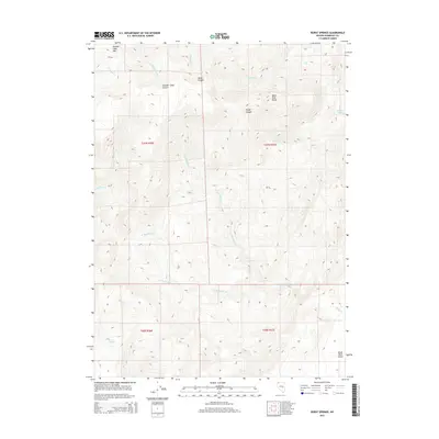
2015 Map of Burnt Springs
USGS Topo · Published 2015About this map
Summit Lake Mtn and the Black Rock Range dominate this high-desert landscape in northern Humboldt County. The terrain is defined by a complex drainage system where seasonal watercourses like Bartlett Creek and S Fork Mahogany Creek carve through steep canyons including Wood Canyon and Rough Canyon. In the lower elevations, the land transitions toward the edge of the Black Rock Desert, a stark contrast to the mountainous peaks to the north.
Find a feature on this map
58 named features on this map. Tap any name to fly to it.
Don’t see what you’re looking for? This feature index may not catch every label — zoom into the map to look around manually.
Map Details
Editions of this 2015 Burnt Springs Map
This is the sole edition of this map. No revisions or reprints were ever made.
Other maps of this area

1886 · Disaster
USGS Topo · 1:250,000

1889 · Long Valley
USGS Topo · 1:250,000

1893 · Disaster
USGS Topo · 1:250,000

1954 · Vya
USGS Topo · 1:250,000

1958 · Vya
USGS Topo · 1:250,000

1962 · Vya
USGS Topo · 1:250,000

1965 · Idaho Canyon
USGS Topo · 1:62,500

1965 · Rock Spring Table
USGS Topo · 1:62,500

1972 · Pinto Mountain
USGS Topo · 1:24,000

1972 · Burnt Springs
USGS Topo · 1:24,000