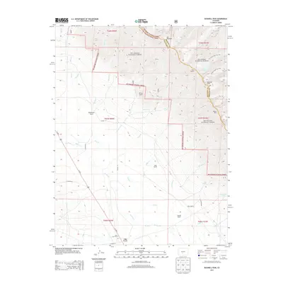
2013 Map of Bushnell Peak
USGS Topo · Published 2013About this map
Villa Grove sits at the southwestern edge of this landscape, serving as a primary settlement point near the Villa Grove Cem and the junction of Us 285 N. The terrain is defined by the high elevations of the Sangre de Cristo Range, where the boundary between San Isabel National Forest and Rio Grande National Forest follows the jagged ridgeline between Saguache and Fremont counties. High-altitude landmarks like Bushnell Peak and Mount Otto overlook a network of drainage systems including San Luis Cr and Kerber Cr. The presence of several backcountry routes, such as the Bushnell Lakes Trail 1402 and Stout Creek Lakes Trail 1403, indicates a landscape largely preserved for conservation and recreation, while naming conventions like Euclid Gulch and Richie Gulch hint at the historical prospecting and ranching that once characterized these mountain canyons.
Find a feature on this map
51 named features on this map. Tap any name to fly to it.
Don’t see what you’re looking for? This feature index may not catch every label — zoom into the map to look around manually.
Map Details
Editions of this 2013 Bushnell Peak Map
This is the sole edition of this map. No revisions or reprints were ever made.
Other maps of this area

1950 · Valley View Hot Springs
USGS Topo · 1:24,000

1954 · Pueblo
USGS Topo · 1:250,000

1956 · Montrose
USGS Topo · 1:250,000

1957 · Pueblo
USGS Topo · 1:250,000

1958 · Pueblo
USGS Topo · 1:250,000

1959 · Montrose
USGS Topo · 1:250,000

1959 · Bonanza
USGS Topo · 1:62,500

1959 · Howard
USGS Topo · 1:62,500

1960 · Montrose
USGS Topo · 1:250,000

1962 · Pueblo
USGS Topo · 1:250,000