
1950 Map of Valley View Hot Springs
USGS Topo · Published 1970About this map
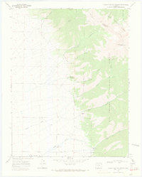
The Valley View School stands as a central landmark in this agricultural and mining landscape of Saguache, Colorado. Compiled in part from 1948 aerial photography, the map reveals a network of water management features essential for high-plains farming, including the Loloff Reservoir, Gilmore Ditch, and Latham Ditch. These man-made channels snake across the terrain to redirect flow from Box Elder Creek and its old channel.
Find a feature on this map
16 named features on this map. Tap any name to fly to it.
Don’t see what you’re looking for? This feature index may not catch every label — zoom into the map to look around manually.
Map Details
Editions of this 1950 Valley View Hot Springs Map
This is the sole edition of this map. No revisions or reprints were ever made.
Other maps of this area

1954 · Pueblo
USGS Topo · 1:250,000

1957 · Pueblo
USGS Topo · 1:250,000

1958 · Pueblo
USGS Topo · 1:250,000

1959 · Electric Peak
USGS Topo · 1:62,500

1959 · Howard
USGS Topo · 1:62,500

1959 · Cotopaxi
USGS Topo · 1:62,500

1962 · Pueblo
USGS Topo · 1:250,000

1966 · Pueblo
USGS Topo · 1:250,000
1967 · Valley View Hot Springs
USGS Topo · 1:24,000
1967 · Villa Grove
USGS Topo · 1:24,000