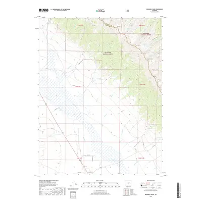
2019 Map of Bushnell Peak
USGS Topo · Published 2019About this map
Villa Grove sits at the edge of the high-altitude San Luis Valley, serving as a gateway between the valley floor and the dramatic peaks of the Sangre de Cristo Range. The settlement landscape is defined by the proximity of the Villa Grove Cem and the surrounding agricultural grid, which gives way to the wilderness of the Rio Grande National Forest and San Isabel National Forest. High-country water features such as West Cr Lake, Stout Cr Lakes, and Bushnell Lakes mark the headwaters of numerous drainages including Raspberry Cr and Brook Cr. The terrain rises sharply to the east, anchored by prominent summits like Bushnell Peak, Mt Otto, and the Twin Sisters. This map documents a region where high-mountain topography meets valley ranching, characterized by deep gulches like Jack Gulch and Carr Gulch and the winding course of San Luis Cr.
Find a feature on this map
55 named features on this map. Tap any name to fly to it.
Don’t see what you’re looking for? This feature index may not catch every label — zoom into the map to look around manually.
Map Details
Editions of this 2019 Bushnell Peak Map
This is the sole edition of this map. No revisions or reprints were ever made.
Other maps of this area

1950 · Valley View Hot Springs
USGS Topo · 1:24,000

1954 · Pueblo
USGS Topo · 1:250,000

1956 · Montrose
USGS Topo · 1:250,000

1957 · Pueblo
USGS Topo · 1:250,000

1958 · Pueblo
USGS Topo · 1:250,000

1959 · Montrose
USGS Topo · 1:250,000

1959 · Bonanza
USGS Topo · 1:62,500

1959 · Howard
USGS Topo · 1:62,500

1960 · Montrose
USGS Topo · 1:250,000

1962 · Pueblo
USGS Topo · 1:250,000