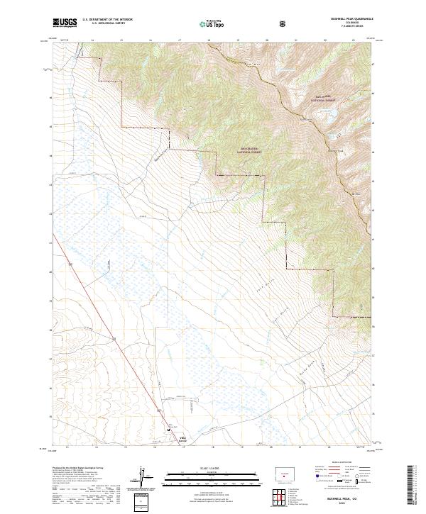
2022 Map of Bushnell Peak
USGS Topo · Published 2022About this map
Villa Grove serves as the primary gateway to the high-altitude terrain at the junction of Saguache and Fremont counties, where the Rio Grande National Forest and San Isabel National Forest meet. The settlement sits at the edge of the valley floor, marked by the Villa Grove Cem and a network of rural routes like Co RD ll56 and Co RD 57. The landscape rises sharply to the east, transitioning from the wetlands of San Luis Cr to the massive peaks of the Sangre de Cristo Range.
Find a feature on this map
54 named features on this map. Tap any name to fly to it.
Don’t see what you’re looking for? This feature index may not catch every label — zoom into the map to look around manually.
Map Details
Editions of this 2022 Bushnell Peak Map
This is the sole edition of this map. No revisions or reprints were ever made.
Other maps of this area

1950 · Valley View Hot Springs
USGS Topo · 1:24,000

1954 · Pueblo
USGS Topo · 1:250,000

1956 · Montrose
USGS Topo · 1:250,000

1957 · Pueblo
USGS Topo · 1:250,000

1958 · Pueblo
USGS Topo · 1:250,000

1959 · Montrose
USGS Topo · 1:250,000

1959 · Bonanza
USGS Topo · 1:62,500

1959 · Howard
USGS Topo · 1:62,500

1960 · Montrose
USGS Topo · 1:250,000

1962 · Pueblo
USGS Topo · 1:250,000