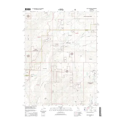
2015 Map of Butte Meadows
USGS Topo · Published 2015About this map
Butte Meadows sits at a high-elevation crossroads within the Lassen National Forest, where the headwaters of several major northern California drainage systems originate. This 2015 survey details the rugged geography at the junction of Tehama and Butte counties, showcasing a landscape defined by sharp ridges and deep creek canyons. The map tracks the course of historic thoroughfares like Humboldt Rd and the Skyway, which connect the small settlement at Butte Meadows to surrounding landmarks. Notable water features include Big Chico Cr and the W Br Feather River, which carve through the terrain near peaks such as Bull Hill and Gold Hill. Genealogists and local historians can locate specific sites like the Cornelia Lott Sank Memorial Spring near Cuddleback Flat, and named geographical points like Ike Dye Hill and Soda Springs.
Find a feature on this map
54 named features on this map. Tap any name to fly to it.
Don’t see what you’re looking for? This feature index may not catch every label — zoom into the map to look around manually.
Map Details
Editions of this 2015 Butte Meadows Map
This is the sole edition of this map. No revisions or reprints were ever made.
Other maps of this area

1886 · Lassen Peak
USGS Topo · 1:250,000

1888 · Bidwell Bar
USGS Topo · 1:125,000

1891 · Bidwell Bar
USGS Topo · 1:125,000

1891 · Chico
USGS Topo · 1:125,000

1892 · Lassen Peak
USGS Topo · 1:250,000

1893 · Chico
USGS Topo · 1:125,000

1893 · Bidwell Bar
USGS Topo · 1:125,000

1894 · Lassen Peak
USGS Topo · 1:250,000

1895 · Bidwell Bar
USGS Topo · 1:125,000

1895 · Chico
USGS Topo · 1:125,000