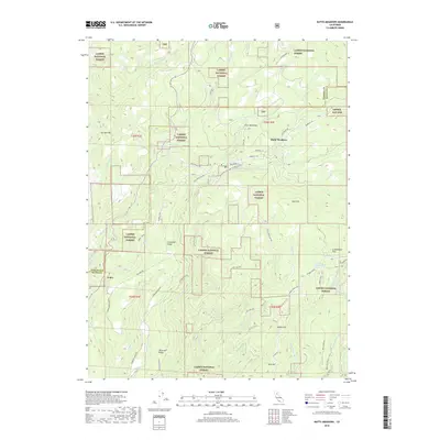
2018 Map of Butte Meadows
USGS Topo · Published 2018About this map
Butte Meadows sits at a geographic crossroads within the Lassen National Forest in this 2018 survey. The landscape is defined by the high ridges and deep creek drainage systems that feed into the Central Valley and the Feather River basin. Prominent peaks and family-named landmarks like Ike Dye Hill, Bottle Hill, and Gold Hill rise above the timbered slopes, while settlements such as Chico Meadows and Soda Springs are connected by a network of forest roads including Humboldt Rd and the Skyway.
Find a feature on this map
60 named features on this map. Tap any name to fly to it.
Don’t see what you’re looking for? This feature index may not catch every label — zoom into the map to look around manually.
Map Details
Editions of this 2018 Butte Meadows Map
This is the sole edition of this map. No revisions or reprints were ever made.
Other maps of this area

1886 · Lassen Peak
USGS Topo · 1:250,000

1888 · Bidwell Bar
USGS Topo · 1:125,000

1891 · Bidwell Bar
USGS Topo · 1:125,000

1891 · Chico
USGS Topo · 1:125,000

1892 · Lassen Peak
USGS Topo · 1:250,000

1893 · Chico
USGS Topo · 1:125,000

1893 · Bidwell Bar
USGS Topo · 1:125,000

1894 · Lassen Peak
USGS Topo · 1:250,000

1895 · Bidwell Bar
USGS Topo · 1:125,000

1895 · Chico
USGS Topo · 1:125,000