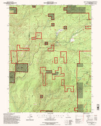
1995 Map of Butte Meadows
USGS Topo · Published 1997About this map
Butte Meadows serves as the focal point of this mountain landscape during the mid-1990s, situated at the junction of the Humboldt Road and Skyway. The settlement is closely tied to the surrounding Lassen National Forest, containing the Butte Meadows Cem and a Forest Service Work Center. This era of land management is visible through the patchwork of forest boundaries and the inclusion of Camp Lassen (BSC) and Hawkins Camp.
Find a feature on this map
36 named features on this map. Tap any name to fly to it.
Don’t see what you’re looking for? This feature index may not catch every label — zoom into the map to look around manually.
Map Details
Editions of this 1995 Butte Meadows Map
This is the sole edition of this map. No revisions or reprints were ever made.
Other maps of this area

1886 · Lassen Peak
USGS Topo · 1:250,000

1888 · Bidwell Bar
USGS Topo · 1:125,000

1891 · Bidwell Bar
USGS Topo · 1:125,000

1891 · Chico
USGS Topo · 1:125,000

1892 · Lassen Peak
USGS Topo · 1:250,000

1893 · Chico
USGS Topo · 1:125,000

1893 · Bidwell Bar
USGS Topo · 1:125,000

1894 · Lassen Peak
USGS Topo · 1:250,000

1895 · Bidwell Bar
USGS Topo · 1:125,000

1895 · Chico
USGS Topo · 1:125,000