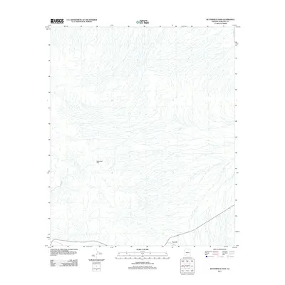
2011 Map of Butterfield Pass
USGS Topo · Published 2011About this map
Butterfield Pass is the central topographical landmark in this southwestern Maricopa County landscape, where the desert floor is defined by a dense network of intermittent drainage channels. The small settlement of Estrella sits at the southern edge of the quadrangle, serving as a rare point of human habitation in a region characterized by its hydrological features. Water management in this arid environment is reflected in the placement of Conley Tank, a vital resource for livestock or wildlife in a territory otherwise marked by seasonal washes. A single paved artery, S Bullard Ave, enters from the northeast, providing one of the few formal connections to the broader Phoenix metropolitan fringe. The geography here is a study in desert drainage patterns, showing how the landscape funnels runoff through the pass toward the plains below.
Find a feature on this map
4 named features on this map. Tap any name to fly to it.
Don’t see what you’re looking for? This feature index may not catch every label — zoom into the map to look around manually.
Map Details
Editions of this 2011 Butterfield Pass Map
This is the sole edition of this map. No revisions or reprints were ever made.
Other maps of this area

1951 · Estrella
USGS Topo · 1:62,500

1951 · Gila Bend
USGS Topo · 1:62,500

1951 · Mobile
USGS Topo · 1:62,500

1951 · Cotton Center
USGS Topo · 1:62,500

1953 · Ajo
USGS Topo · 1:250,000

1954 · Phoenix
USGS Topo · 1:250,000

1957 · Ajo
USGS Topo · 1:250,000

1957 · Phoenix
USGS Topo · 1:250,000

1958 · Ajo
USGS Topo · 1:250,000

1958 · Phoenix
USGS Topo · 1:250,000