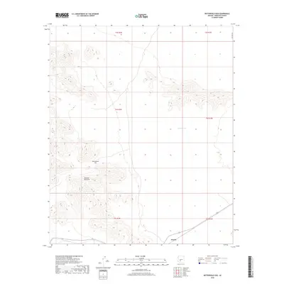
2018 Map of Butterfield Pass
USGS Topo · Published 2018About this map
Maricopa Mountains dominate this arid landscape, characterized by the prominent topographic notch of Butterfield Pass. This corridor through the peaks serves as a vital natural thoroughfare in a region defined by steep elevation changes and desert basins. The small settlement of Estrella sits at the southern edge of the quadrangle, positioned near the road network that skirts the mountain foothills. Water resources are scarce in this environment, with Conley Tank representing one of the few named catchment features in the area. The map illustrates a transition from the structured grid of S Bullard Ave in the northeast toward the more complex, natural terrain of the range. The alignment of township boundaries like t4s r2w and t4s r1w highlights the intersection of public land survey systems with the geological reality of the Arizona desert.
Find a feature on this map
11 named features on this map. Tap any name to fly to it.
Don’t see what you’re looking for? This feature index may not catch every label — zoom into the map to look around manually.
Map Details
Editions of this 2018 Butterfield Pass Map
This is the sole edition of this map. No revisions or reprints were ever made.
Other maps of this area

1951 · Estrella
USGS Topo · 1:62,500

1951 · Gila Bend
USGS Topo · 1:62,500

1951 · Mobile
USGS Topo · 1:62,500

1951 · Cotton Center
USGS Topo · 1:62,500

1953 · Ajo
USGS Topo · 1:250,000

1954 · Phoenix
USGS Topo · 1:250,000

1957 · Ajo
USGS Topo · 1:250,000

1957 · Phoenix
USGS Topo · 1:250,000

1958 · Ajo
USGS Topo · 1:250,000

1958 · Phoenix
USGS Topo · 1:250,000