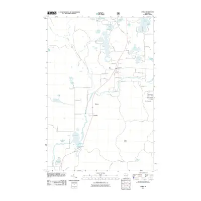
2011 Map of Cable
USGS Topo · Published 2011About this map
The Namekagon River winds southward through this 2011 survey of Bayfield County, serving as the central geographic artery for the settlement at Cable. The village is established at a critical junction of roads and rail, flanked to the west by the Greenwood Cemetery and Saint Anne Cemetery. Further south, smaller stops at Radspur and Leonards suggest the historical importance of the transportation corridor following the river valley.
Find a feature on this map
80 named features on this map. Tap any name to fly to it.
Don’t see what you’re looking for? This feature index may not catch every label — zoom into the map to look around manually.
Map Details
Editions of this 2011 Cable Map
This is the sole edition of this map. No revisions or reprints were ever made.
Other maps of this area

1943 · Namekagon Lake
USGS Topo · 1:48,000

1944 · Drummond
USGS Topo · 1:48,000

1944 · Grandview
USGS Topo · 1:48,000

1944 · Hayward
USGS Topo · 1:48,000

1945 · Namekagon Lake
USGS Topo · 1:48,000

1947 · Drummond
USGS Topo · 1:48,000

1947 · Grandview
USGS Topo · 1:48,000

1953 · Ashland
USGS Topo · 1:250,000

1958 · Ashland
USGS Topo · 1:250,000
1971 · Upper Eau Claire Lake
USGS Topo · 1:24,000