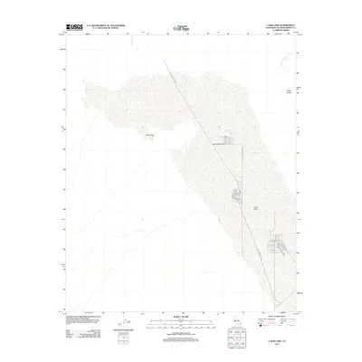
2012 Map of Cadiz Lake
USGS Topo · Published 2012About this map
Cadiz Lake dominates this desert landscape in the eastern Mojave, where industrial salt extraction intersects with shifting sands. The map details the massive footprint of the lake bed and its surrounding Cadiz Valley, an area characterized by drainage patterns like Watson Wash and Browns Wash. A striking feature of the early 21st-century terrain is the Salt Evaporation Rd, which leads to a series of distinct evaporation ponds carved into the salt crust. To the northeast, the Cadiz Dunes provide a stark contrast to the flat, mineral-rich expanse of the dry lake basin. This survey documents the intersection of natural desert geomorphology and large-scale industrial mineral recovery during a period of ongoing resource development in San Bernardino County.
Find a feature on this map
6 named features on this map. Tap any name to fly to it.
Don’t see what you’re looking for? This feature index may not catch every label — zoom into the map to look around manually.
Map Details
Editions of this 2012 Cadiz Lake Map
This is the sole edition of this map. No revisions or reprints were ever made.
Other maps of this area

1942 · Amboy
USGS Topo · 1:250,000

1943 · Amboy
USGS Topo · 1:250,000

1943 · Cadiz Lake
USGS Topo · 1:62,500

1943 · Cadiz Valley
USGS Topo · 1:62,500

1954 · Needles
USGS Topo · 1:250,000

1956 · Needles
USGS Topo · 1:250,000

1956 · Dale Lake
USGS Topo · 1:62,500

1956 · Bristol Lake
USGS Topo · 1:62,500

1956 · Cadiz Lake
USGS Topo · 1:62,500
1956 · Cadiz Valley
USGS Topo · 1:62,500