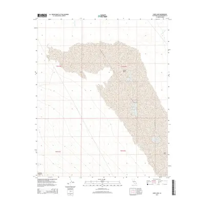
2015 Map of Cadiz Lake
USGS Topo · Published 2015About this map
Industrial mineral extraction defines the landscape of the Cadiz Valley in this remote section of the Mojave Desert. The presence of Salt Evaporator Plant Rd indicates a focus on saline resources, with numerous evaporation ponds and industrial infrastructure clustered in the eastern half of the map. This industrial activity is framed by the natural drainages of Watson Wash to the north and Browns Wash to the northeast, which feed toward the low-lying valley floor. To the southwest, the rising terrain of the Calumet Mountains provides a distinct geological boundary to the flat, salt-crusted expanse. This 2015 survey provides a clear look at the scale of commercial evaporation operations in one of California's most arid environments.
Find a feature on this map
10 named features on this map. Tap any name to fly to it.
Don’t see what you’re looking for? This feature index may not catch every label — zoom into the map to look around manually.
Map Details
Editions of this 2015 Cadiz Lake Map
This is the sole edition of this map. No revisions or reprints were ever made.
Other maps of this area

1942 · Amboy
USGS Topo · 1:250,000

1943 · Amboy
USGS Topo · 1:250,000

1943 · Cadiz Lake
USGS Topo · 1:62,500

1943 · Cadiz Valley
USGS Topo · 1:62,500

1954 · Needles
USGS Topo · 1:250,000

1956 · Needles
USGS Topo · 1:250,000

1956 · Dale Lake
USGS Topo · 1:62,500

1956 · Bristol Lake
USGS Topo · 1:62,500

1956 · Cadiz Lake
USGS Topo · 1:62,500
1956 · Cadiz Valley
USGS Topo · 1:62,500