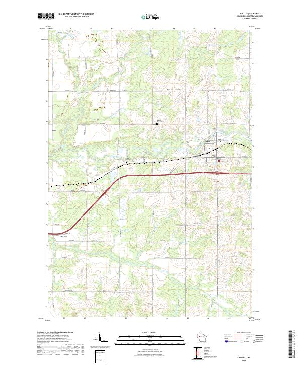
2022 Map of Cadott
USGS Topo · Published 2022About this map
The village of Cadott serves as the focal point for this Chippewa County landscape, where the Yellow River cuts a path through the rolling agricultural terrain of north-central Wisconsin. The mapping reveals a dense network of country roads following the Public Land Survey System grid, interrupted only by the diagonal path of the river and several prominent creeks. Local genealogy and land use history are well-represented by numerous rural burial grounds, including the Buetow Family Cem, Union Cem, and Goetz Cem.
Find a feature on this map
57 named features on this map. Tap any name to fly to it.
Don’t see what you’re looking for? This feature index may not catch every label — zoom into the map to look around manually.
Map Details
Editions of this 2022 Cadott Map
This is the sole edition of this map. No revisions or reprints were ever made.
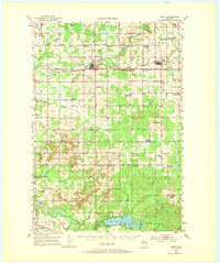
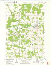
Historical Maps of Anson Through Time
3 maps found