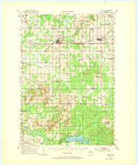
1952 Map of Cadott
USGS Topo · Published 1973About this map
Cadott and Boyd serve as the primary hubs along the northern corridor of this 1952 landscape, where the Soo Line railroad connects these small Wisconsin communities. The survey records a dense network of rural infrastructure, particularly the high frequency of local schoolhouses that defined central Wisconsin’s educational geography in the mid-20th century. While many districts remained active, such as East Anson Sch and Oak Knoll Sch, the transition of the era is evident in several labels marked as out of use, including School No 7 (Abandoned) and Delmar Center Sch (Abandoned).
Find a feature on this map
66 named features on this map. Tap any name to fly to it.
Don’t see what you’re looking for? This feature index may not catch every label — zoom into the map to look around manually.
Map Details
Editions of this 1952 Cadott Map
2 editions found

Other maps of this area

1927 · Strum
USGS Topo · 1:62,500

1930 · Strum
USGS Topo · 1:62,500

1934 · Chippewa Falls
USGS Topo · 1:62,500

1935 · Osseo
USGS Topo · 1:48,000

1936 · Chippewa Falls
USGS Topo · 1:62,500

1940 · Osseo
USGS Topo · 1:62,500

1948 · Fairchild
USGS Topo · 1:62,500

1949 · Fairchild
USGS Topo · 1:62,500

1949 · Bloomer
USGS Topo · 1:62,500

1951 · Bloomer
USGS Topo · 1:62,500