
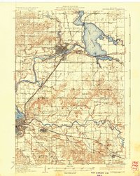
1936 Map of Chippewa Falls
USGS Topo · Published 1936About this map
Chippewa Falls and Eau Claire anchor this mid-1930s landscape, a region defined by the convergence of the Chippewa River and the Eau Claire River. The vast Lake Wissota dominates the northeastern quadrant, its waters held back by the power infrastructure near the Northern Wisconsin Training School. This era shows a transition from water-powered industry toward modern transportation, with the Chicago St Paul Minneapolis and Omaha railroad and State Trunk Highway No 29 facilitating movement across the townships of Hallie and Lafayette. Rural life remains centered on local institutions, evidenced by dozens of named country schools like Rheingans Sch and Crandle Sch. Notable landmarks such as Irvine Park and historic sites like Old Badger Mills provide specific points of interest for local historians and genealogists tracing early twentieth-century property lines and community centers.
Find a feature on this map
81 named features on this map. Tap any name to fly to it.
Don’t see what you’re looking for? This feature index may not catch every label — zoom into the map to look around manually.
Map Details
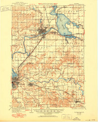
Editions of this 1936 Chippewa Falls Map
3 editions found
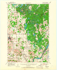
Other maps of this area

1927 · Strum
USGS Topo · 1:62,500

1930 · Strum
USGS Topo · 1:62,500

1932 · Mondovi
USGS Topo · 1:62,500

1934 · Elk Mound
USGS Topo · 1:62,500

1934 · Chippewa Falls
USGS Topo · 1:62,500

1935 · Osseo
USGS Topo · 1:48,000

1936 · Elk Mound
USGS Topo · 1:62,500

1940 · Osseo
USGS Topo · 1:62,500
1949 · Bloomer
USGS Topo · 1:62,500

1949 · New Auburn
USGS Topo · 1:62,500