
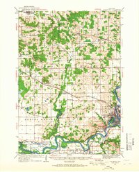
1934 Map of Elk Mound
USGS Topo · Published 1960About this map
The Chippewa River carves a deep path through this mid-1930s landscape, serving as a primary corridor for the Chicago St Paul Minneapolis and Omaha RR and the Chicago Milwaukee St Paul and Pacific RR. The rail lines converge near the growing city of Eau Claire, where industrial sites like Porters Mills and recreation spots like Carson Park and the Polo Grounds define the urban edge. To the west, the village of Elk Mound sits beneath the prominent Panther Hill, surrounded by a dense network of country schoolhouses that anchored rural life.
Find a feature on this map
69 named features on this map. Tap any name to fly to it.
Don’t see what you’re looking for? This feature index may not catch every label — zoom into the map to look around manually.
Map Details
Editions of this 1934 Elk Mound Map
2 editions found
Other maps of this area

1927 · Strum
USGS Topo · 1:62,500

1929 · Durand
USGS Topo · 1:62,500

1930 · Strum
USGS Topo · 1:62,500

1932 · Durand
USGS Topo · 1:62,500

1932 · Mondovi
USGS Topo · 1:62,500

1934 · Chippewa Falls
USGS Topo · 1:62,500

1936 · Chippewa Falls
USGS Topo · 1:62,500

1936 · Elk Mound
USGS Topo · 1:62,500

1940 · Menomonie
USGS Topo · 1:62,500

1942 · Menomonie
USGS Topo · 1:62,500