
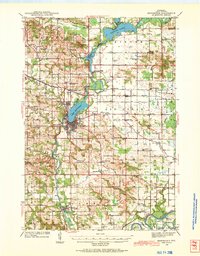
1940 Map of Menomonie
USGS Topo · Published 1965About this map
The Red Cedar River flows south through the heart of this Dunn County landscape, punctuated by the central hub of Menomonie and its adjacent Lake Menomin. This 1940s-era survey reveals a densely settled rural network characterized by numerous family-named school districts and local landmarks. To the east of the city, the County Asylum and County Home represent significant civic infrastructure of the period, while the northern reaches are dominated by the broad waters of Tainter Lake. The mapping of small settlements like Cedar Falls and Downsville, alongside the tracks of the Chicago and North Western and the Chicago Milwaukee St Paul and Pacific railroads, illustrates a region still deeply tied to its rail-and-river transport roots. Genealogists will find a wealth of data in the many local burying grounds, such as Iron Creek Cem and Sherman Cem, and scattered rural schools like Knapp Settlement Sch.
Find a feature on this map
77 named features on this map. Tap any name to fly to it.
Don’t see what you’re looking for? This feature index may not catch every label — zoom into the map to look around manually.
Map Details
Editions of this 1940 Menomonie Map
2 editions found
Other maps of this area

1929 · Durand
USGS Topo · 1:62,500

1932 · Durand
USGS Topo · 1:62,500

1932 · Mondovi
USGS Topo · 1:62,500

1934 · Elk Mound
USGS Topo · 1:62,500

1935 · Arkansaw
USGS Topo · 1:48,000

1936 · Elk Mound
USGS Topo · 1:62,500

1941 · Arkansaw
USGS Topo · 1:62,500

1942 · Arkansaw
USGS Topo · 1:62,500

1942 · Menomonie
USGS Topo · 1:62,500

1946 · Knapp
USGS Topo · 1:62,500