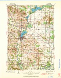
1940 Map of Menomonie
USGS Topo · Published 1969About this map
The Cedar River and Chippewa River define the local economy and geography of this central Dunn County landscape. At the center of the sheet, Menomonie sits as a regional hub, connected to industrial satellites like Cedar Falls and Downsville via the Chicago and North Western RR. The prevalence of small rural institutions, such as Little Elk Creek Ch and dozens of country schoolhouses like Beyer Settlement Sch and Knapp Settlement Sch, illustrates a densely settled agricultural society before the consolidation of the mid-20th century. Notable land use is further evidenced by the County Asylum and County Home, reflecting early 20th-century social services located on the periphery of the main town. The formation of Lake Menomin and Tainter Lake highlights the significant hydroelectric and recreational changes along the Red Cedar waterway during this era.
Find a feature on this map
89 named features on this map. Tap any name to fly to it.
Don’t see what you’re looking for? This feature index may not catch every label — zoom into the map to look around manually.
Map Details
Editions of this 1940 Menomonie Map
2 editions found
Other maps of this area

1929 · Durand
USGS Topo · 1:62,500

1932 · Durand
USGS Topo · 1:62,500

1932 · Mondovi
USGS Topo · 1:62,500

1934 · Elk Mound
USGS Topo · 1:62,500

1935 · Arkansaw
USGS Topo · 1:48,000

1936 · Elk Mound
USGS Topo · 1:62,500

1940 · Menomonie
USGS Topo · 1:62,500

1941 · Arkansaw
USGS Topo · 1:62,500

1942 · Arkansaw
USGS Topo · 1:62,500

1942 · Menomonie
USGS Topo · 1:62,500