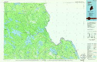
1986 Map of Calais
USGS Topo · Published 1986About this map
The St Croix River defines the international boundary in this mid-1980s look at Washington County, where the waterways of the Down East interior meet the tides of Passamaquoddy Bay. The landscape is dominated by an intricate network of glacial lakes and ridges, from Baskahegan Lake in the north to the expansive Meddybemps Lake and Cathance Lake further south. This era shows the continued importance of the lumber and paper industry's geography, with the Maine Central and Canadian Pacific railroads threading through timberlands and plantations.
Find a feature on this map
196 named features on this map. Tap any name to fly to it.
Don’t see what you’re looking for? This feature index may not catch every label — zoom into the map to look around manually.
Map Details
Editions of this 1986 Calais Map
This is the sole edition of this map. No revisions or reprints were ever made.
Other maps of this area

1907 · Eastport
USGS Topo · 1:48,000

1908 · Eastport
USGS Topo · 1:62,500

1929 · Calais
USGS Topo · 1:48,000

1929 · Robbinston
USGS Topo · 1:48,000

1929 · Lead Mountain
USGS Topo · 1:48,000

1930 · Vanceboro
USGS Topo · 1:48,000

1931 · Springfield
USGS Topo · 1:48,000

1931 · Robbinston
USGS Topo · 1:62,500

1932 · Calais
USGS Topo · 1:62,500

1932 · Nicatous Lake
USGS Topo · 1:48,000