
1932 Map of Nicatous Lake
USGS Topo · Published 1932About this map
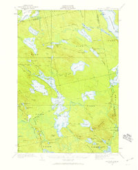
Nicatous Lake and its surrounding water system anchor this interior Maine landscape, reflecting a region defined by recreational camps and private sporting clubs in the early 1930s. The shoreline is dotted with specific markers of early 20th-century outdoor culture, such as the Explorers Club on Burnt Island and the New York Club near the Narrows. These camps, including Maple Grove Camp Ground and the Adler Tavern Camp, suggest a well-established seasonal economy centered on the region's complex hydrology. The drainage of the Passadumkeag River and the sprawling wetlands of Thousand Acre Heath dominate the northern terrain, while the eastern edge follows the Machias Lake watershed. This survey, compiled in part from early Air Corps aerial photography, provides a distinct look at the transition from the lake-rich lowlands to the ridges of Morrison Ridge.
Find a feature on this map
70 named features on this map. Tap any name to fly to it.
Don’t see what you’re looking for? This feature index may not catch every label — zoom into the map to look around manually.
Map Details
Editions of this 1932 Nicatous Lake Map
4 editions found
Other maps of this area

1920 · Winn
USGS Topo · 1:62,500

1929 · Great Pond
USGS Topo · 1:48,000

1929 · Lead Mountain
USGS Topo · 1:48,000

1931 · Springfield
USGS Topo · 1:48,000

1931 · Saponac
USGS Topo · 1:48,000

1932 · Lead Mountain
USGS Topo · 1:62,500

1932 · Great Pond
USGS Topo · 1:62,500

1934 · Saponac
USGS Topo · 1:62,500

1934 · Nicatous Lake
USGS Topo · 1:62,500

1934 · Springfield
USGS Topo · 1:62,500